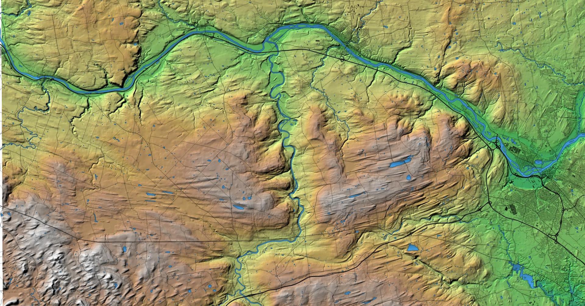
Terrain Map: Northern Schoharie Creek Download a High Resolution JPEG Image of the Terrain Northern Schoharie Creek or an Adobe Acrobat Printable PDF of the Terrain Northern Schoharie Creek. About Northern Schoharie Creek .... With this rendering I continue my fascination with the Lost Valley of the Schoharie Creek. More about Schoharie Valley...Maps and InteractivesSchoharie Valley Topographic MapNational Land Cover Dataset – Schoharie ValleyMiddleburgh CliffBohringer’s Fruit Farm and Shauls Farm FieldsShauls Farms Lands in Schoharie CountySchoharie ValleyNorthern Schoharie Creek... photos, maps and other content from from Schoharie Valley. Leave a Reply Cancel replyYour email address will not be published. Required fields are marked *Comment * Name * Email * Website Save my name, email, and website in this browser for the next time I comment. Δ
More about Schoharie Valley...Maps and InteractivesSchoharie Valley Topographic MapNational Land Cover Dataset – Schoharie ValleyMiddleburgh CliffBohringer’s Fruit Farm and Shauls Farm FieldsShauls Farms Lands in Schoharie CountySchoharie ValleyNorthern Schoharie Creek... photos, maps and other content from from Schoharie Valley.
Leave a Reply Cancel replyYour email address will not be published. Required fields are marked *Comment * Name * Email * Website Save my name, email, and website in this browser for the next time I comment. Δ
