New York City 📍

🖼️ Photos 📽️ Videos

Dunning Mountain

The top of Dunning Mountain has long been blown away in the strip mining of coal in the mountain. The side of the mountain was cut into to build a dual carriageway for what is now Interstate 99 decades later.

Sunday October 13, 2019 — Washington Square
Map: Ketchumville State Forest

Smallbany and Lower Manhattan – Queens, A Size Comparison

Albany is pretty small in area compared to New York City, as seen on this map that shows Albany, as area within the beltways of the Thruway - Interstate 90 Northside Route - Northway - Interstate 787 compared to Lower Manhattan Queens.

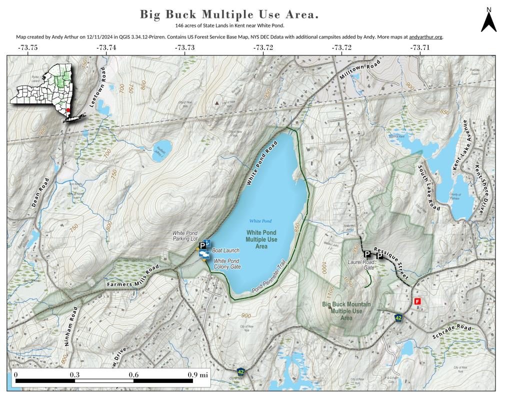
Map: Big Buck State Forest And White Pond

Van Cortlandt Park, 1951

Already 70 years ago, the park was criss-crossed by parkways, with more in mind by the Robert Moses and the Master Builders.

Map: Andersen Hill And Potato Hill State Forest
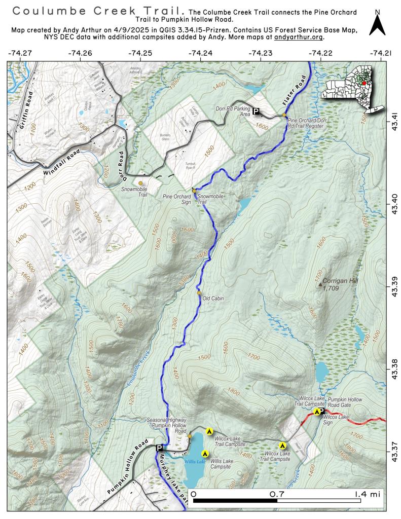
Map: Coulumbe Creek Trail

Gowanus Parkway 1951

By the early 1950s, the modern Gowanus Expressway hadn't been built yet but the 14th Street had been upgraded to be partly grade seperated as a feeder to the Battery Tunnel. 

OpenStreetMap: One of the World's Largest Collaborative Geospatial Projects - GIS Lounge