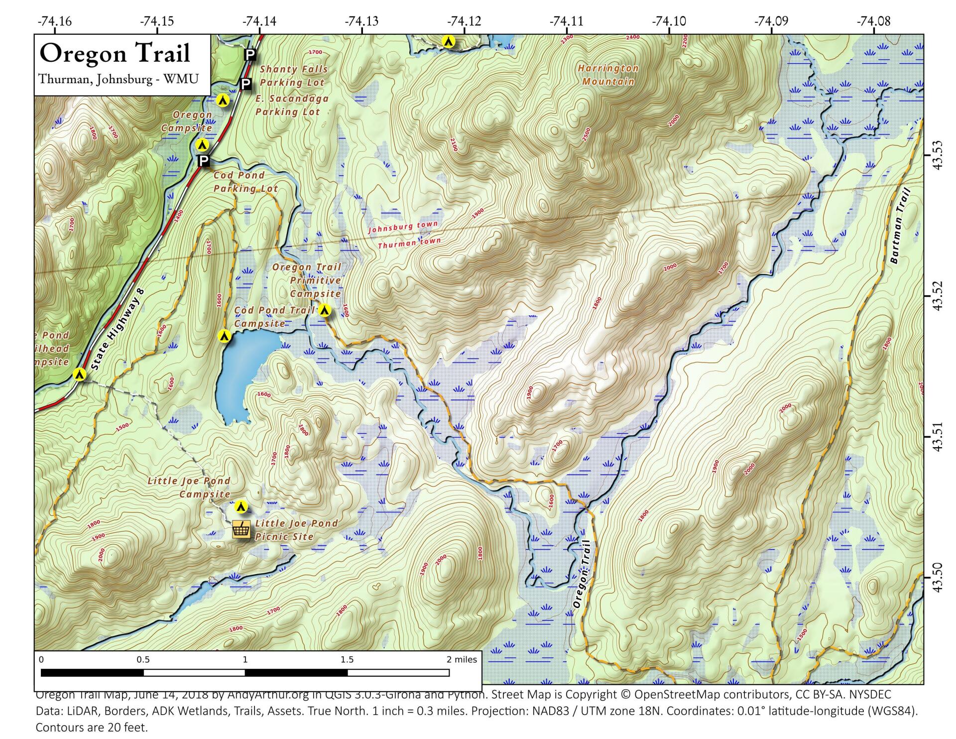
Oregon Trail
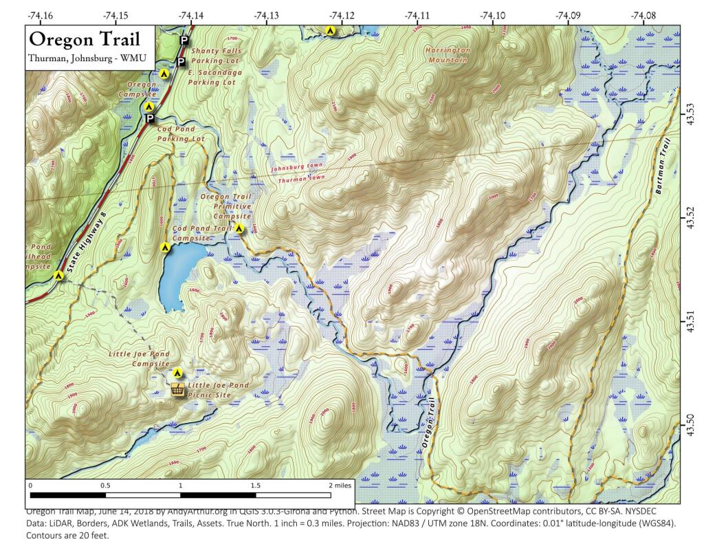
Download a High Resolution JPEG Image of the Oregon Trail or an Adobe Acrobat Printable PDF of the Oregon Trail.
Bookmark my free Interactive GPS Map for your phone:
https://andyarthur.org/ny
... shows your location as a blue dot in relationship to campsites, trails, state land. This online map requires cell service, won't work in remote country, so also bring a paper map.
Free Download of New & Historical USGS 1:24k Topograpic Maps
Interactive maps with backcountry and roadside camping: New York, Pennsylvania, West Virginia & Vermont. List of NYS DEC Lean-Tos and Firetowers.
Google Spreadsheet with Roadside, Primitive and Pay Campsites
More about Wilcox Lake Wild Forest...
Wilcox Lake Wild Forest is located in the southeastern part of the Central Adirondacks and is made up of approximately 140,000 acres of State Forest Preserve lands in Warren, Hamilton, Saratoga and Fulton Counties. Nearby communities include Stony Creek, Thurman, Bakers Mills, Day, Wells, Hope Falls, and Northville.
Wilcox Lake Wild Forest is bounded on the north by NY 8, on the east by the Hudson River, on the south by the Adirondack Park Blue Line, and on the west by NY 30. This wild forest offers many recreational opportunities, including hiking to the fire tower on Hadley Mountain, camping on Wilcox Lake, and ice fishing on Garnet Lake. With over forty-five miles of marked trails available, there are countless opportunities for hiking, skiing, and snowmobiling in the unit.
Download the PDF Map Pack with All Maps from Wilcox Lake Wild Forest.


