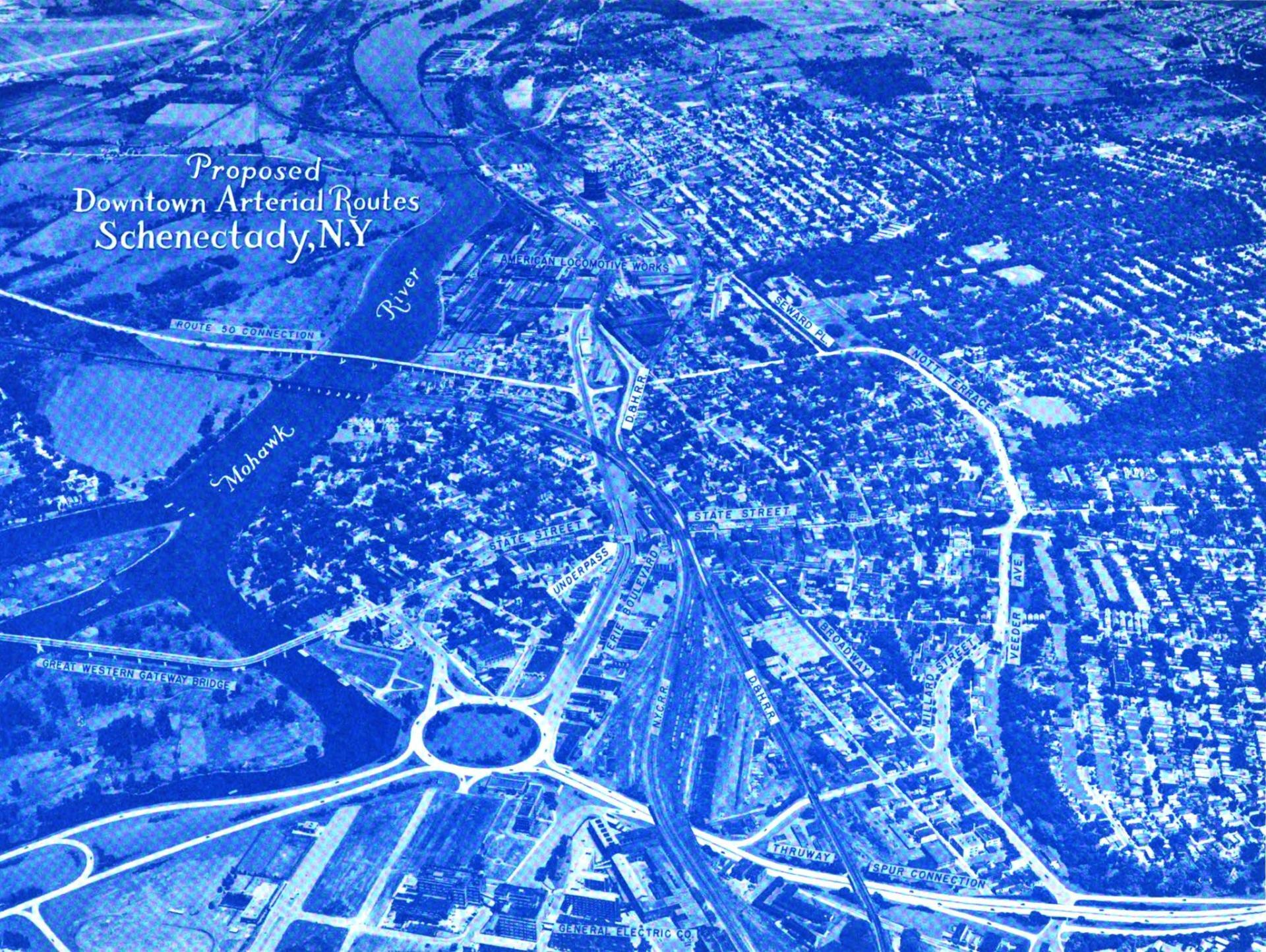
Proposed Aerterials in Schenectady, 1947 🗺️

Download a High Resolution JPEG Image of the Proposed Aerterials in Schenectady, 1947 or an Adobe Acrobat Printable PDF of the Thematic Proposed Aerterials in Schenectady, 1947.
About Proposed Aerterials in Schenectady, 1947 ....
The yet to be built Interstate 890 took a similar route, but ended up in a large traffic circle at Erie Boulevard in the 1947 Proposed Downtown Arterial Routes study. The Route 50 Connection also was never built, with most traffic continuing to use the Great Western Gateway Bridge or Freeman's Bridge.

More about Schenectady County...
Schenectady County is a county located in the U.S. state of New York. As of the 2010 census, the population was 154,727. It is part of the Albany-Schenectady-Troy Metropolitan Statistical Area. The county seat is Schenectady. Schenectady County is located west of Albany on the Mohawk River, and contains both the river and uplands around it.


