Dutch Settlement State Forest
Download a High Resolution JPEG Image of the Dutch Settlement State Forest or an Adobe Acrobat Printable PDF of the Dutch Settlement State Forest.

Bookmark my free Interactive GPS Map for your phone:
https://andyarthur.org/ny
... shows your location as a blue dot in relationship to campsites, trails, state land. This online map requires cell service, won't work in remote country, so also bring a paper map.
Free Download of New & Historical USGS 1:24k Topograpic Maps
Interactive maps with backcountry and roadside camping: New York, Pennsylvania, West Virginia & Vermont. List of NYS DEC Lean-Tos and Firetowers.
Google Spreadsheet with Roadside, Primitive and Pay Campsites
More about Dutch Settlement State Forest...
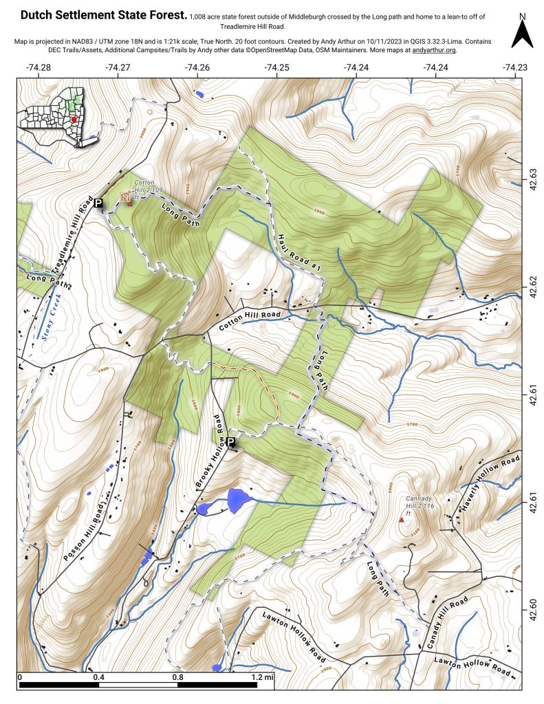
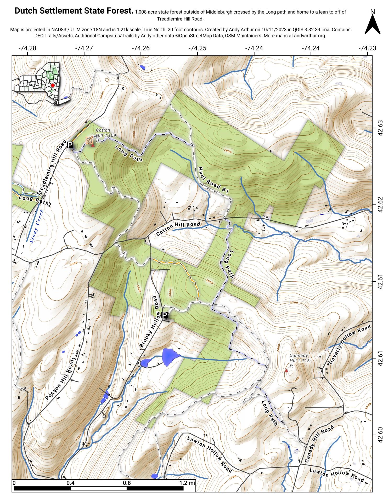
Consisting of one of the highest hills above the Schoharie Valley, the 860-acre Dutch Settlement State Forest is crossed by the Long Path and has a lean-to, off of Treadlemire Road in Middleburgh. The village of Middleburgh is roughly 5 miles down Cotton Hill Road from here.
Cotton Hill State Forest is nearby Dutch Settlement State Forest and is commonly confused -- as the summit of Cotton Hill is in Dutch Settlement State Forest and not Cotton Hill State Forest, which was acquired first. Part of the long path runs along Cotton Hill State Forest.


