Derailuered
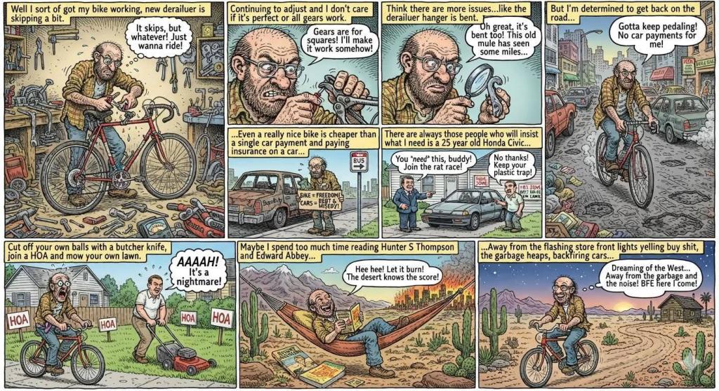
Well I sort of got my bike working, new derailuer is skipping a bit. Continuing to adjust and I don't care if it's perfect or all gears work. Think there are more issues than the derailuer like the derailuer hanger is bent. Among many other issues with the bike, I ride it hard, many miles and do most of my own maintenance often with bit the greatest tools.
But I'm determined to get back on the road even if it does eventually mean seeking professional help or getting another bike. Even a really nice bike is cheaper than a single car payment and paying insurance on a car plus the SuperDuty. Plus I absolutely hate driving to work though the local bus and transferring to the shuttle or second bus ain't my favorite either.
There are always those people who will insist what I need is a 25 year old Honda Civic and a plastic covered house with asphalt shingles to live in with a 100 square foot television and high speed internet in every room. With weekly garbage service and air conditioning. Sit in bumper to bumper traffic, cut off your own balls with a butcher knife, join a HOA and mow your own lawn. I can only imagine how much I'd bleed after doing such things even if I'd heard Rocky Mountain Oysters are tasty.
Maybe I spend too much time reading Hunter S Thompson and Edward Abbey, or up in the wilderness watching shit burn, giggling in the hammock. Stories about the west and wilderness. Away from the flashing store front lights yelling buy shit, the garbage heaps, backfiring cars that billow smoke and sewage treatment works. Dreaming of far away places, looking at off grid cabins, farms and ranches and places out west or at least in BFE. But in the mean time I really like riding my bike to work and around town and it would be so hard to give it up in favor of a tacky plastic house and a 25 year old Honda Civic.
Saturday July 11, 2026 — Bicycles