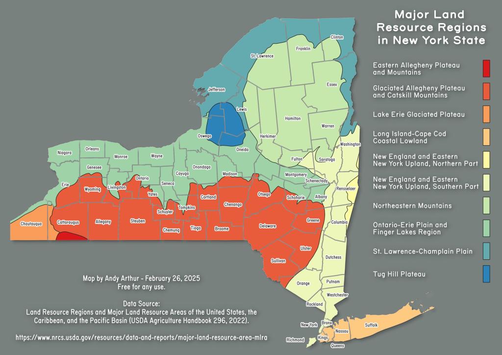
Major Land Resource Regions
Download a High Resolution JPEG Image of the Major Land Resource Regions or an Adobe Acrobat Printable PDF of the Major Land Resource Regions.
About Map: Major Land Resource Regions ....
This map shows the various major land resource regions that dominate the landscape in New York and influence the land activities on them such as farming, grazing, timber and recreation.
Bookmark my free Interactive GPS Map for your phone:
https://andyarthur.org/ny
... shows your location as a blue dot in relationship to campsites, trails, state land. This online map requires cell service, won't work in remote country, so also bring a paper map.
Free Download of New & Historical USGS 1:24k Topograpic Maps
Interactive maps with backcountry and roadside camping: New York, Pennsylvania, West Virginia & Vermont. List of NYS DEC Lean-Tos and Firetowers.
Google Spreadsheet with Roadside, Primitive and Pay Campsites
More about Agriculture...
Download the PDF Map Pack with All Maps from Agriculture.
")


No Comments
Hi, is it possible to get permission to use the image of the Major Land Resource for NY in a training presentation?
Sure that is fine to use this map. Thanks!