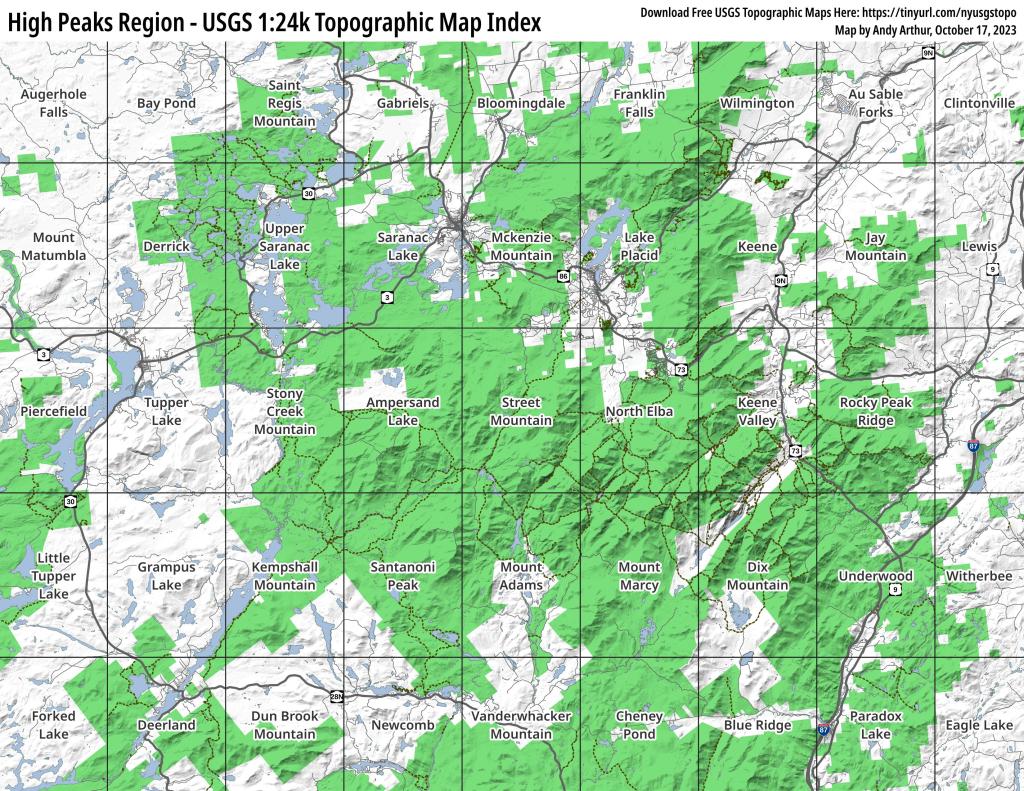
High Peaks Region – USGS 1:24k Topographic Map Index
This map provides a handy, printable index of all USGS 1:24k Topographic Maps in the High Peaks region.
Download Free USGS Topographic Maps Here: https://tinyurl.com/nyusgstopo

This map provides a handy, printable index of all USGS 1:24k Topographic Maps in the High Peaks region.
Download Free USGS Topographic Maps Here: https://tinyurl.com/nyusgstopo
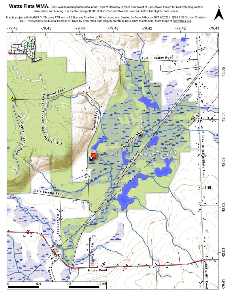
44.22080561052468,-74.30630484336764
Stoney Creek Pond is located south of NY 3 on Corey's Road. It can be accessed by the 1/2 mile Indian Carry from NY 3 (Tupper Lake Highway) or a shorter 1/10 mile Stony Creek Pond Carry.

From the Hammond Pond Parking Area on Moriah Road (4 miles east of US 9), head south on the Berrymill Flow Trail. The flow is roughly 1 1/2 miles south of the parking area, with only a very slight incline. Head south-east on the Mouse Mountain Pond Trail another 1 1/2 miles to reach the lake which contains a lean-to on the north shore. Slight incline, gaining 200 feet before dropping over a ridge to the pond.
https://andyarthur.org/hammond-pond
https://www.dec.ny.gov/lands/109807.html

1.2 mile leg-stretcher hike, easily accessed from US 9, just south of Exit 28 Ticonderoga on the Adirondack Northway. Good views of Paradox Lake and Schroon Lake from this mountain. Trail goes under the Adirondack Northway in a culvert.